Showing posts with label Exploring Virtually. Show all posts

EV83

Back in the early days of LockDown I did a series of blog posts based on desk-based exploration of some of the sheets pulled at random from my collection of OS Landranger sheets - all part of planning what I was going to do After LockDown. 

That little bit of virtual exploration included 10 sheets from Shetland down to the Borders and to Dumfries and Galloway.  At the time I promised to do a further set of sheets but got otherwise distracted.

So, resuming where I left off - Series Two - OS Landranger Sheet 83 - Newton Stewart & Kirkcudbright.

This is one of the sheets I know fairly well.  It covers the area between the Galloway Forest, and the Galloway coast - mostly Wigtown Bay.

The main road across the sheet from west to east is the A75 - linking Stranraer (and the boats to Northern Ireland) and Castle Douglas (just off the eastern edge of the sheet).  I've driven (or more accurately, been driven) across this sheet more times that I can remember - travelling between my childhood home just outside Belfast and a grand-parental home in the Scottish Borders (on OS Landranger Sheet 79).

I can see there are also fragments of disused railway line at various places on the map - but I suspect these were Beeching casualties - and that they were also long gone when I was using British Rail to get to Stranraer in my student days.

These visits both by car and (potentially) by train were long long ago - however I have had one real (as opposed to virtual) visit to the area in more recent years. 

Three landmarks I picked out for that visit were

(i) Threave Castle. On Threave Island in the middle of the River Dee and one-time home of the 'Black Douglases'. I've got lots Douglas connections in my family tree but haven't yet been able to claim a direct link!

Threave Castle

(ii) Isle of Whithorn.  Which isn't currently an isle at all - but once was an important pilgrimage site.

St Ninians Chapel, Isle of Whithorn

(iii) Ross. Aside from natural curiosity, I think I mostly went here so I could hear my sat nav announcing "Ross. You've arrived in Ross." as I arrived in Ross.  Around the time I was visiting (in 2017) the nearby island of Little Ross was on the market - complete with lighthouse and a macabre history.  We decided not to put in an offer. 

Ross Bay

And for the next visit?  Like a lot of this coastline there are a huge number of little bays and inlets to explore - and I think a bit more time to do just that would be good.  The other place that would deserve a visit is Wigtown  - known for the abundance of second-hand bookshops, and for the annual Book Festival.

And from the southwest corner of Scotland - the next step (in real life requiring quite a lot of road miles, and then an overnight ferry then at least one more ferry after that) is to Sheet 1 (Shetland: Yell, Unst & Fetlar).


More Exploring (Virtually)

I've found that spending a bit of time concentrating on each Landranger Sheet is turning out to be a really good LockDown activity - and it's helping me to figure out my Real Grand Tour for After The LockDown

So I've tumbled the random generator again and it's rolled out a further set of suggested sheets...

And this is what Series II looks like


As with the first Series the tour will go from the Shetland Islands to the Borders, and from the Highlands to the Islands.  Some of the sheets I know very well, others I'm pretty sure I've not (yet) visited - at least not properly.

Sheet 83 Newton Stewart & Kirkcudbright : Have certainly visited this sheet, and have explored both the coastline and Galloway Forest.  Last time I visited - I declared that a further visit was needed!

Sheet 1 Shetland - Yell, Unst & Fetlar : Good to have another proper Northern sheet included - and as OS maps go, they don't go much further north.

Sheet 11 Thurso & Dunbeath : In mainland terms this one is quite 'North' - and it includes the Flow Country which is worth travelling a long way to visit. And one often has to.

Sheet 30 Fraserburgh : Have visited this sheet several times - it's on one of my 'scenic' routes from Aviemore to Aberdeen.

Sheet 36 Grantown & Aviemore : And speaking of Aviemore.  The sheer tattiness of this sheet (in comparison with the others) gives evidence about how often I've been to this sheet.  It's also worth confessing that I've got three copies of this sheet - and this is the least disreputable.

Sheet 43 Braemar & Blair Atholl : Another sheet that appears in my collection of scenic routes between Aviemore and Aberdeen.

Sheet 24 Raasay & Applecross : There's a fighting chance that I've not visited this sheet - and it's high time that I did,

Sheet 54 Dundee & Montrose : Have visited this sheet numerous time en route to Aberdeen from the south of Scotland - but wouldn't have claimed to have 'explored' it.

And why only eight episodes this time?

The random number generator suggested I also revisit Sheets 61 and 68 - and at this stage that felt like over-egging whatever it is that one shouldn't over-egg.


EV70

Part of a series - exploring Scotland map by map - for more background

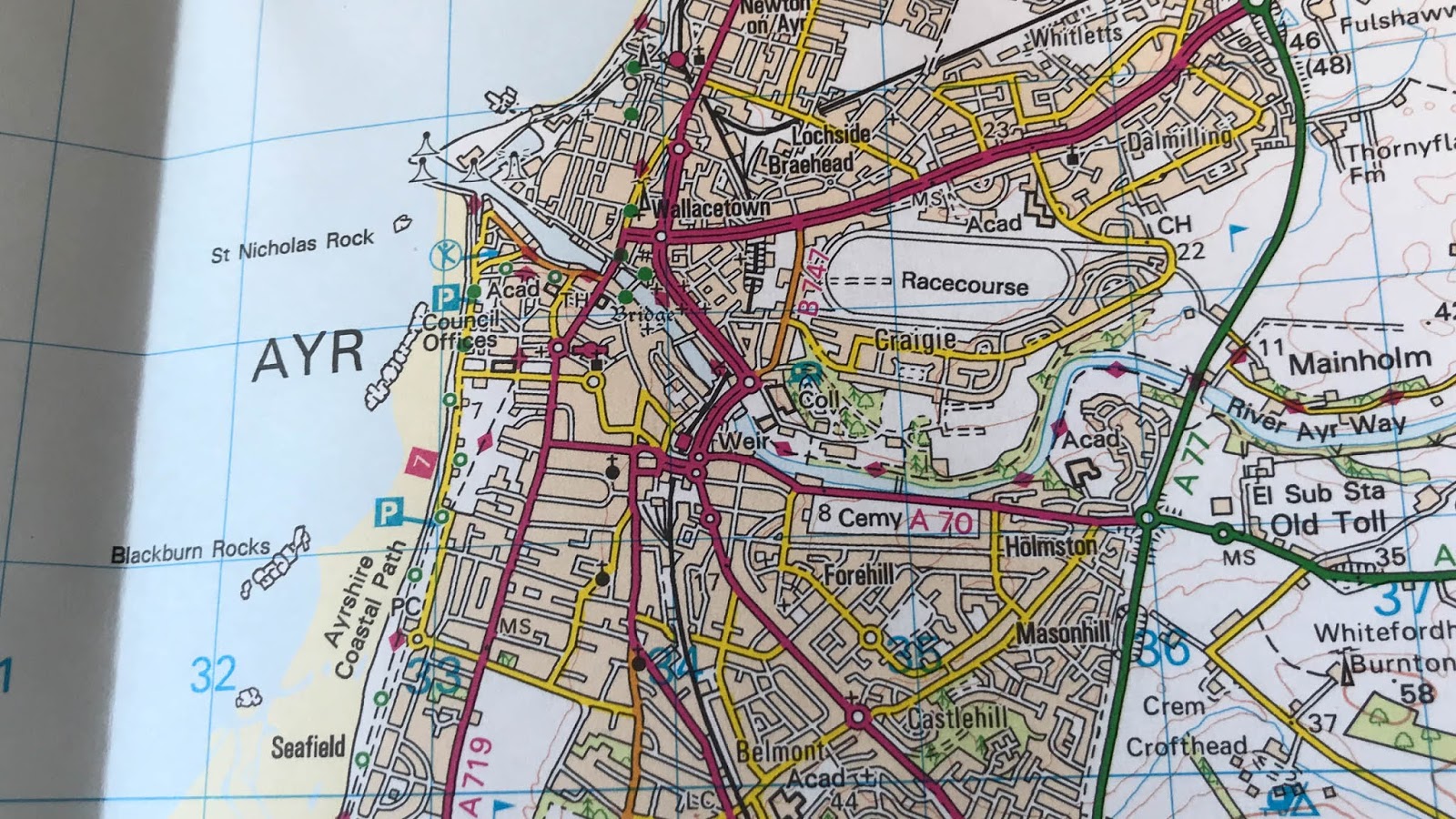
Exploring (Virtually) OS Landranger Sheet 70 : Ayr, Kilmarnock & Troon


The final stop is this tour (although I think that now I've started, I might need to carry on) swoops back down to the southwest of Scotland, and the Ayrshire coast.

The coast runs right down the sheet taking in a whole of familar place names - from Ardrossan, to Troon, to Ayr and then on south past Culzean Castle.   And that's before you start to add in the numerous golf courses dotted along the coast.  The landward side of the maps is decidedly busy - lots roads and a few railway lines (both current and dismantled).

Dotted right along the coastline is the very tempting Ayrshire Coastal Path  - which runs (or walks) from just north of Stranraer right up to Largs, the middle 65 km of the entire 150 km is on Sheet 70.

And my new-found bit of Scottish geography knowledge for this sheet - while I had heard of both Irvine and Ayr (and could have probably placed them on a map), I wasn't aware of either the River Irvine or the River Ayr (and there is even a River Ayr Way to explore).


And have I ever visited this sheet?

I started writing this with a clear "No".

However as I've wandered (virtually) around the sheet recollections of student-era rail journeys have re-surfaced. On a number of occasions, when finances were 'restricted', I caught a train from Bristol to Crewe and then got a seat on the overnight sleeper train from Euston to Stranraer - and I'm pretty sure that the train would have come through Ayr towards the end of the journey.

So "Yes" I have visited this sheet at least a few times - but I think it deserves a proper return visit.

EV53

Part of a series - exploring Scotland map by map - for more background

Exploring (Virtually) OS Landranger Sheet 53 : Blairgowrie and Rattray, Forest of Alyth

River Tay, through Perth (October 2018)

Moving just a few miles southwest from the previous sheet bring us to Blairgowrie - although the sheet might be better named as 'Perth to Pitlochry' (the first being on the southern edge and the other on the northern edge) - and while its mostly an inland sheet, it does just manage to include a wee bit of the Firth of Tay.

The sheet does have a few contour-dominated areas - the Forest of Alyth, Forest of Clunie and Glen Shee, but the initial impression when you unfold the sheet is of a 'developed' area.  There are lots of towns and villages and lots of roads - including the M90, A9, A90 and A93 - and the main railway lines from Perth up to Inverness and to Aberdeen.

I'm driven (and trained) across this sheet many times, Perth has been a regular stopping point both heading north and south, as has Pitlochry when heading up to Aviemore or Inverness. As I've been writing this I've been distracted by thinking about how many times I might have driven up (or down) the A9 or the A90 - I think further research is going to be needed.

As with so many of the 'transit' sheets - ones I've driven across rather than 'visited', I'm left with a long list of places I ought to visit (or revisit) properly rather than just use them as service areas.

Of course the key to properly exploring an area is to find somewhere to park the car and to start exploring at 3 or 4 miles per hour, rather than 50 or 60 miles per hour.  Like so many of the sheets in this part of Scotland, there's a trail to follow - in this case the Cataran Trail, which starts and finishes in Blairgowrie and goes along Strathardle (then heads off onto Sheet 43) before appearing down Glen Isla and meandering through Alyth and back to Bridge of Cally. I've just added this to my walks list!


EV44

Part of a series - exploring Scotland map by map - for more background

Exploring (Virtually) OS Landranger Sheet 44 : Ballater & Glen Clova

Cambus o May Suspension Bridge, November 2013

After a couple of stops down south, the latest map is back north in the Cairngorms - the Cairngorms National Park covers about half of Sheet 44 - and although there isn't any coast line, there are a lot of contours.  There are some dramatic steep sided valleys that just cry out to be visited and photographed - like Loch Muich at the top of Glen Muich, and Glen Clova.

One of my Cairngorm confessions is that although I've visited many many times, I've almost always climbed and walked from the Spey-side rather than from the Braemar side.   Maybe I should repeat my Lairig Ghru project but visit from the east side of the mountains.

So does that mean I've not visited this sheet?  Not at all - I've crossed bits of this sheet many many times.  There are two A-roads shown on this sheet - the A90 and the A93 (and one or two other bits feeding into the A93).

There are about three miles of the A90 down in the south east corner of the sheet (just outside Brechin) - and I must have driven those three miles dozens of times heading to or from the the boat in Aberdeen.

And up on the northern edge of the map, the A93 runs right across the sheet finding its way past Balmoral Castle, Ballater and Aboyne.   On the A90, I've probably never even paused but I have stopped at least occasionally along the A93.  I can recall stopping at (but not visiting) Balmoral and the famous wee church at Crathie.   I've also got evidence of stopping for at least a brief walk around the footbridge over the Dee at Cambus o May.  The picture was taken back in 2013 (when it was still possible to cross) - I gather that storm damage in 2015 made that impossible and that this is still the case in 2020.

I'm sure I'll drive the A-roads again - but I think a trip up some of the glens is called for soon.

EV71

Part of a series - exploring Scotland map by map - for more background

Exploring (Virtually) OS Landranger Sheet 71 : Lanark & Upper Nithsdale


Moving just 50 miles east makes a huge difference to the landscape.  The previous sheet included lots of coast and sea, this one is completely inland - and is filled with place names I recognise, but would struggle to place accurately on a map of Scotland.

I certainly recognise some of places from road signs on the M74.  I've driven up and and down that road more times than is sensible - heading to or from Edinburgh, or the Cairngorms or Aberdeen - and barring brief pit-stops at the services at Abington (down in the SE corner), I'm not sure I've ever stopped in this sheet.

And what am I going to do when I get to visit this sheet in real life?

There's a copy of the Cicerone guide to the Southern Upland Way on the shelf in my study - I got rather put off when I realised that it was way over 200 miles long.  About 30 of those miles twist their way tortuously up and down through the Lowther Hills - going through Sanquhar (a name I'm told I ought to recognise - there's a knitting connection) and Wanlockhead (a name I do recognise - there's a pub connection).  The former is the home of a traditional black and white knitting pattern, the latter the location of the highest village and highest pub in Scotland.

If you scour the northern edges of the map the area the area around Lanark and New Lanark, not only does it appear to be the end of the railway line, it also appears to be the end (or perhaps the beginning) of the Clyde Walkway.  And since I've made a point of trying to visit UNESCO World Heritage sites in lots of countries - it seems a bit daft that I've not been to New Lanark. It would seem to be a good starting point for the 40 mile stroll down the Clyde (a 40 mile trail feels a bit more approachable than a 200 mile one).

Exploring New Lanark

The map also reveals lots of signs of a local mining past ("opencast workings" and "Coalburn" are a bit of clue) and a wind-farming present just west of the village of Douglas and just south of New Cumnock.

Visits? Numerous transits - next time, I will stop!


EV68

Part of a series - exploring Scotland map by map - for more background

Exploring (Virtually) OS Landranger Sheet 68 : South Kintyre & Campbelltown


Continuing what is becoming a grand (but virtual) tour of the Scottish coastline, by moving just a few miles south from Jura & Colonsay to the Kintyre Peninsula and the Isle of Arran.  There's a small (but inevitably virtual) prize for anyone who can see reference to the "Mull of Kintyre" without hearing that song.  And you really don't want to Google "Mull of Kintyre Test".

The Kintyre Peninsula stretches south from the Scottish mainland towards Northern Ireland, by the time you reach Southend you're probably no more than 15 miles from the Antrim coast - close enough for this to be one of the 'suggested' sites for the "Northern Irish Bridge". Much of southern Kintyre coastline is defended by cliffs with just a few gaps where roads come down to the water.

Getting to Southend (the little village at the south end) is a bit of a haul - if you want to get here by road from the Scottish Central Belt, you'll wind up needing go along the bonnie, bonnie banks of Loch Lomond (there's another ear-worm for you) then round the top of Loch Long and Loch Fyne before starting to make your way back south towards Campbeltown.  There is, according to some sources, the alternative of a direct ferry from Troon or maybe Ardrossan, or more credibly via Arran. And you might even be able to fly directly into the wee airport outside Campbeltown - once (like so many Scottish island airports) an RAF station - RAF Machrihanish - which had very long Cold War-era runways.

In addition to the cliffs and the airport, the two other features leap out from this Landranger sheet are the extent of woodland, and the number of wind turbines on the peninsula - these are in two major wind farms, one at Tangy on the west coast with 20-odd turbines and a bigger one (60-something turbines) at Beinn an Tuirc.

If you have the urge to visit under your own power there is the 100-mile Kintyre Way which twists it's way from Tarbert (on OSL 62) down the peninsula to Campbell then round the east and south coast before ending up at Machrihanish.

Exploring Southend at the south end.

A feature this areas shares with both Sheet 61 and with Sheet 28 from earlier in the tour (maybe this is becoming a grand whisky tour!) is a distilling tradition.  Once long ago there were numerous distilleries in Campbeltown, but my notes tell me that there are only three left.

On the eastern edge of the sheet - maybe half a dozen miles across Kilbrannan Sound is the Isle of Arran.  Arran does get an OS Landranger Sheet (number 69) all to itself, but on the edge of Sheet 68 is just a taster of what awaits if you head further east.  The impression you get from comparing the two bits of land on each side of the Sound, is that Arran is a more rugged version of Kintyre.  There's a similar mix of forestry land and open land, but the contours are much more closely packed on Arran.  The highest point (I can see) on Kintyre is about 450m above sea level, while I can see (on this sheet) spot heights up to almost 800m on Arran.

Visit?  Not yet.  I'm a wee bit embarrassed to not have visited either Kintyre or Arran.  It's got to be on the post-Lockdown tour - not least for the fresh whisky supplies.

And while I'm there - I might need to figure out how to get to Sanda Island (off the south coast of Kintyre) - it appears to have both a pub and an interesting looking lighthouse.

EV61

Part of a series - exploring Scotland map by map - for more background

Exploring (Virtually) OS Landranger Sheet 61 : Jura & Colonsay


From the far north to the west coast.  This sheet has just as much blue as the previous sheet on the tour - and it includes several islands - the two headline islands (Jura & Colonsay) plus a bit of Islay too.

Jura is about 30 miles long (it fits rather neatly onto a single OS Landranger sheet) - and can be summarised as having "one road, one hotel and one distillery". The one road goes from the ferry port (just across from Port Askaig on Islay and runs round the south coast of the island, up the east coast past the Jura Distillery and the Jura Hotel (both in the main (only?) town, Craighouse) to Lussa Bay.  The landscape is pretty bare, except along the road where there are some bits of woodland, with the most memorable feature being the Paps of Jura (where you'll find, what might be, the one trig point, at 785m).

If you want to venture on past the end of the road, there is a track - and once that peters out, you can keep going up to the northern tip of Jura, you'll then be overlooking the Gulf of Corryvrecken - with a notorious whirlpool.

Further west from Jura is the even more remote island of Colonsay - it's a lot smaller than Jura (only about 10 miles from end to end, but has a similar population - it's also got one hotel and one distillery (gin, this time) and does at least have a loop of single-track road.  The island is pretty low lying (the high point is less that 500 feet). 

Along south west coast of Jura is the narrow Sound of Islay, separating Jura from Islay.  At the narrowest point of the Sound (on the Islay) side is Port Askaig, where the ferry from Kennecraig on the Scottish mainland comes in - and the first thing you'll notice when you get off the ferry is that there are real two-way roads (with paint down the middle and everything), the second thing you'll notice are the signs to the distilleries. Islay has something like 10 distilleries, two of them (Caol Ila & Bunnahabhain) on the bit of Islay that's on this sheet.

And have I visited this sheet? Yes, but only once many years ago.  

I spent a few days on Islay - arriving via Port Askaig, and staying somewhere around the south end of Islay (not on this sheet) - but my recollections are vague, and I've not been able to track down any photographs I took there.  Both Jura and Colonsay are still on my 'must visit' list.

EV2

Part of a series - exploring Scotland map by map - for more background

Exploring (Virtually) OS Landranger Sheet 2 : Shetland - Sullom Voe & Whalsay

Whalsay

From south to north - not quite the northern-most sheet in the Landranger arsenal but close.  Getting onto this sheet is a bit of a haul - you probably want to make your way to Aberdeen, then brace yourself for a 12 or 14 hour ferry crossing (smooth crossings are available, sometimes).  Then once you get off the ferry in Lerwick, turn right and head on up the A970. After about 13 miles you'll have made in onto the southern edge of Sheet 2.

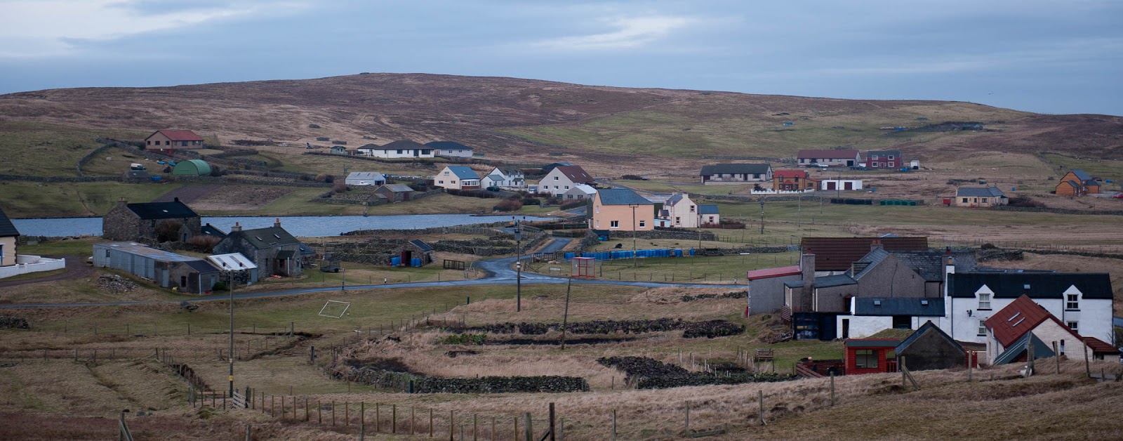
You might want to hang on to your sea boots while you're exploring here (even virtually), you get a lot of blue on this sheet - there are lots of wee ferries, but (on this sheet at least) not many bridges.   Dotted around the islands are some magical place names - some describing the local landscape (but in Norn) and lots of which betray Shetlands traditional Scandinavian links.

Welcome to Fetlar

At the south and west of the sheet you're still on Mainland the (not very imaginative) name for the biggest of the Shetland Islands - but elsewhere you get to see some of the other islands, the bigger ones being Whalsay, Yell and Fetlar. Dotted around these islands are numerous smaller islands, almost all uninhabited.  By one count there are over 300 Shetland Islands, although I'm not sure how big a skerry needs to be to count as an island - you'll certainly find plenty of skerries and holms on this sheet.  You'll find some distinctly creatively named wee islands too, the "Flaeshans of Rumble" is, obviously, just north of "Rumble".

Welcome to Northmavine

If you're very patient you might just find a new island appearing - on the west edge of the sheet is a narrow neck of land that separates Northmavine from the rest of Mainland.  This neck of land (Mavis Grind) was historically the place where boats got dragged up and over so that they could be used on the 'other' coast of Shetland rather than needing to sail all the way round the north end of mainland.  The entrance to Northmavine already has a Holywood-style sign to welcome visitors.

Whalsay Coastline

The bigger islands all have their own stories and traditions. Whalsay was once a Hanseatic trading centre, and is now where most of the big pelagic fishing boats are based.  Fetlar is sometimes called the Garden of Shetland - not many people live there but quite a few visit to see the phalaropes on the Loch of Funzie.  Between Fetlar and Mainland is the island of Yell - for many just somewhere to cross en route to Unst (the most northern of the inhabited Shetland Islands, but you'll need to find Sheet 1 to get there). Yell is however worth a bit more of your time - including more otters than anywhere else, the most haunted house on Shetland and trows (the Shetlandic answer to the trolls in Iceland).

White Wife, Yell - marking the site of a shipwreck in the 1920s

One of the descriptions of Shetland, is that no where is more than three miles from the sea - and if you look around sheet 2, you can well believe that this is true.  The islands themselves are mostly long and narrow, and very often broken up by long narrow voes or firths.

One of these, Sullom Voe, has over the last 40 year been absolutely critical to the economics of Shetland - this has been the place where oil from the North Sea has been brought ashore since the early 1970 - and a wee share of the value of each barrel has gone into the local coffers to pay for facilities across the island.

Visits?  Yes, lots! I've been spending quite a lot of time on Shetland for the last 10 years.  We did at one point look at a couple of houses on the south edge of this sheet - but ultimately opted to be a bit further south.

EV80

Part of a series - exploring Scotland map by map - for more background

Exploring (Virtually) OS Landranger Sheet 80: Cheviot Hills & Kielder Water

Carter Bar (looking North), September 2017

After a couple of more northerly offerings, this post takes us to the Deep South - all the way down to the English Border and beyond.  The title of this sheet tells you about the main two features - the hills which form a natural border and the man-made lake at Kielder Water.

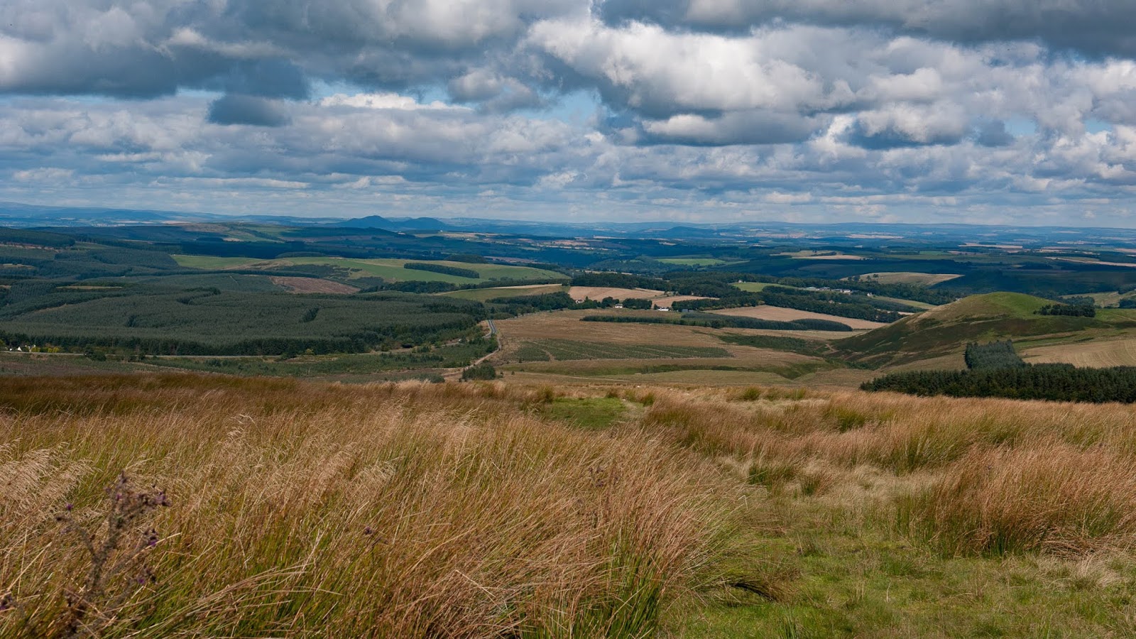
As you look along the ridge of The Cheviot Hills you get glimpses of the 'troubled' history of these parts.  There are lots of bits of Roman road and Roman Camps (far to the north side of Hadrians Wall), there are numerous old forts, standing stones and settlements alongside markers of more recent battles too such as the intriguingly named 'Redeswire Fray 1575' (just beside the Carter Bar).

On the English side of the border is Northumberland National Park, with Kielder Forest and Water just on it's edge - and snaking across the sheet from south to north is the E2 European Long Distance Park, probably better know as the Pennine Way (which tracks along the border for quite a lot of the sheet).  Have to concede that I didn't realise that the Pennine Way came quite this far north!

Also meandering its way across the sheet is the A68 - one of the main routes through the borders - although it probably doesn't see as much traffic as the routes closer to the east and west coasts.

Visits? I've probably been onto this sheet more times than I was aware. I spent many childhood holidays in Hawick (just 4 miles off the western edge of the map) and I recognise lots of the place names on sheet 40 - particularly Denholm and Bonchester Bridge.  I also remember grandparental reference being made to the "Carter Bar" - but I don't think I realised it was a pass through the hills. It was probably entirely reasonable for a youngster to get confused between that and "The Roadhouse" (which was my grandfathers local!)

More recently I've driven up (and down) the A68 as part of re-discovering this bit of Scotland, and have stopped at Carter Bar.


EV42

Part of a series - exploring Scotland map by map - for more background

Exploring (Virtually) OS Landranger Sheet 42:; Glen Garry & Loch Rannoch

Rannoch Station, 2014


This sheet is a bit different from the previous sheet in the series - there are a lots and lots of contours, and no coastline.  The sheet stretches from the southern edge of the Cairngorms National Park, down to Loch Rannoch and the Tay Forest Park - and it's probably one of the most-traversed remote bits of the central Highlands.

At the south-east corner of the sheet is Schiehallion - and spread across much of the southern edge is Rannoch Moor - and tucked neatly into the southwest corner is Rannoch Station - on the West Highland line from Glasgow up to Fort William. The station is a stopping point for through traffic on the railway, but as far as the roads are concerned it is the end of the line.

So how come I've described this as the most-traversed remote bit of the central Highlands? It's simply because both the A9 and the main railway line to the North snake their way from Glen Garry, over the Drumochter Pass and through Glen Truim - and before these existed General Wade built his Military Road following much of the same route (he's left landmarks, The Wade Stone and Wade Bridge).

And have I visited this sheet? Yes, many many times - but not often stopped.

I've travelled the West Highland Line - and the train must have stopped at Rannoch Station.  I've travelled the main line between Perth and Aviemore and on to Inverness several times (and probably stopped at Dalwhinnie Station).  And I've driven up and down the A9 so many times that I can't count them - I've driven across Drumochter in bright sunshine, in pouring rain and in heavy snow - I've driven it in the dead of night (with the temperature showing -12C) and the headlights picking out magnificent stags along the roadside.

And the picture? - taken a few years ago when I went to the end of the road, just to see what was there.

Once the LockDown is over I'll be heading back up the A9 again.

EV28

First in a series - exploring Scotland map by map - for more background

Exploring (Virtually) OS Landranger Sheet 28: Elgin & Dufftown

Mouth of the River Spey, Spey Bay(2018)

This year was going to be all about walking - maybe the second half will yet be.  I had intended to complete the Thames Path (I did do one of the three remaining 'chunks').  I had planned - and booked - a series of walking trips in the Alps (the first one happened, the second one didn't - and the jury is still out on the other two).

Around these I had also hoped to walk two long distance paths in Scotland, the John Muir Way and the Speyside Way. And the last (or first) 40 miles of the Speyside Way runs across OSL28.

The sheet stretches from the northern edge of the Cairngorms National Park up to the Moray Coast and Spey Bay - with Burghead at the western edge of the sheet and Portnockie at the eastern edge. It's also fair to say that in addition to the Speyside Way, the River Spey is the dominant feature and with it a significant proportion of the Speyside distilleries.  I've never seen a league table of distilleries broken down by OS sheet - but I'd take a bet that Sheet 28 is a strong contender to top the table.

The most striking feature of the map when you unfold it, is how much green there is - some sheets are dominated by sea blue, others by the brown shades of closely grouped contour line - here the dominant colour is forest green.

The landscapes on sheet range from close contours of Ben Rinnes (840m) down to the Moray coast at sea level - and the Moray Coastal Trail.

I still intend to walk the Speyside Way - and having looked at the map I think the Moray Coastal Trail would be good too.

Lossiemouth Beach, 2005

And have I visited this sheet? - yes, more times than I'd remembered!

Long long ago we stopped overnight in Elgin as part of a Grand Tour of Scotland by train.  In 2005 I spent a day exploring the coast (while I was trying to blag a job in Inverness) and in 2016 we wound up having a fish supper in a Elgin when we were house-hunting (on the next sheet west) - the fish supper was excellent, but we didn't find the right house.

Most recently, in 2018, I spent time along this coast en route from Aberdeen to Inverness.


Exploring (Virtually)

A couple of years ago I finally completed my Scottish collection of Ordnance Survey Landranger sheets (for sake of tidiness, the northern 88 sheets in the full collection of 204).

This was part of a planned project (The Landranger Project) to visit and take a series of photographs on each sheet.  I got about half-way through the project before work got in the way and my plans to restart the project this summer look pretty dubious at this point.

So, inspired by a recent post on Map Gazing on the WalkHighlands website from Merryn Glover, I'm going (over the next few days) to indulge in some virtual exploring.

I dug out my trusty random number generator and asked it to find me ten maps from my collection.

This is what it recommended

Keeping It Random

Sheet 28 Elgin & Dufftown : Interesting start - the Speyside Way was part of the walking plans for this year. :-(

Sheet 42 Glen Garry & Loch Rannoch : I've certainly been to some of this sheet, but wouldn't say I know it well.

Sheet 80 Cheviot Hills & Kielder Water : Spent many childhood holidays just off the edge off this map, and have visited some bits of it quite recently.

Sheet 2 Shetland - Sullom Voe & Whalsay : Relieved to get at least one Shetland sheet to explore over the next few days.

Sheet 61 Jura & Colonsay : Haven't been to either of the headline islands on this sheet, but have spent time on Islay (albeit quite a few years ago).

Sheet 68 South Kintyre & Campbelltown : Don't think I've made it to this sheet at all!

Sheet 71 Lanark and Upper Nithsdale : I've certainly driven across this sheet (M74!) - but don't think I've done anything more exciting than have coffee and a bacon roll at the Abington Services.

Sheet 44 Ballater & Glen Clova : Again, have certainly crossed this sheet, but possibly not done much more.

Sheet 53 Blairgowrie & Rattray : Have certainly visited both Pitlochry and Perth and (on the top and bottom edges of this sheet), and have driven up and down the A9 between them more times than is sensible.

Sheet 70 Ayr, Kilmarnock & Troon : Got close to this sheet in the early days of my LandRanger project - but don't think I actually made it there.

That set of sheets, which at some point (in my head at least) became a Grand (but Virtual) Tour of Scotland - getting from roughly the centre of each sheet to the next would have been 1300 miles as the crow flies or 1600 miles by road (and in a few cases ferry).

The exercise was intended to encourage me to look more closely at each sheet than I might otherwise have done - and I'm very tempted to add another (randomly generated) series.

And yes - there is now a Series 2.